") Maximize
Maximize ")
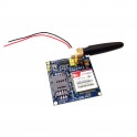
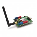
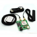
SIM808 GSM/GPRS & GPS Module (Raspberry Pi & Arduino Compatible)
Add this SIM808 GSM / GPRS / GPS Module to your projects to use a GSM cell phone network for wireless communications and get your project's GPS coordinates for location tracking!